Why RightShip developed the Maritime Emissions Portal
Back in 2016, I attended a conference in which a speaker from Google made a presentation that revealed new technology used to track illegal fishing vessels through satellite data, and I began to think about how we could use similar technology to track emissions in port.
Later, Google announced the Google Impact Challenge, which allowed companies to pitch an idea and win $250,000 to develop the concept. We partnered with The Australian Marine Environment Protection Association (AUSMEPA) and won the grant. The funding enabled us to develop a digital tool that could provide emissions inventory data to ports around the world.
How the MEP works
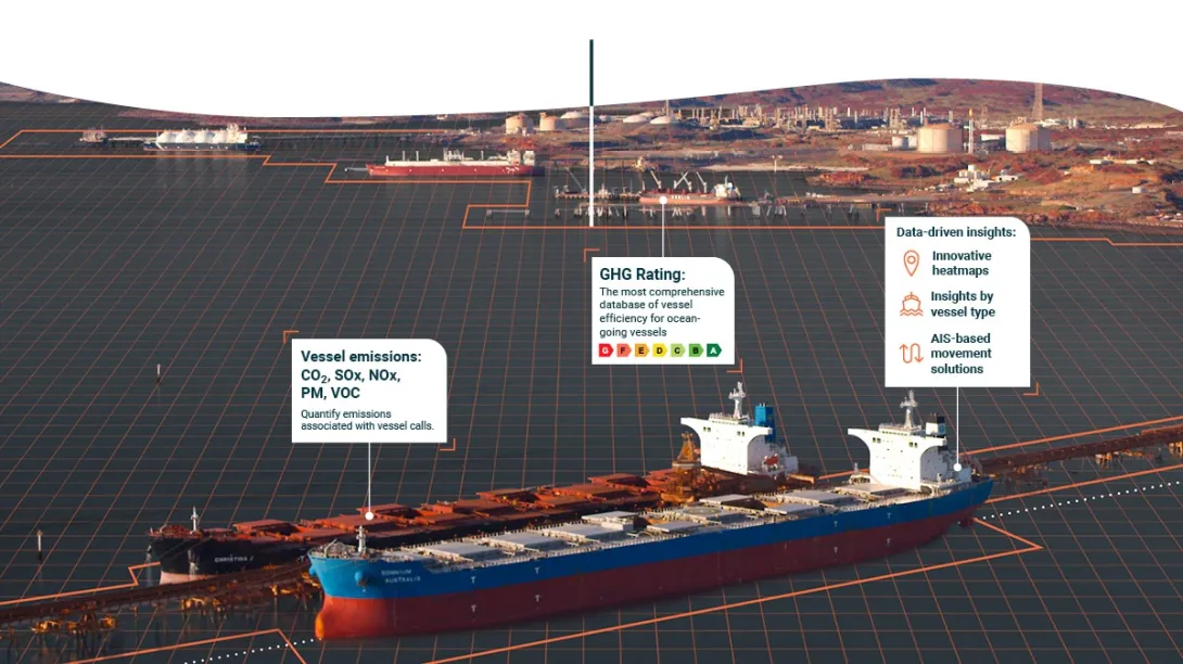
After much research and testing, we designed the MEP using a combination of Automatic Identification System (AIS) movement data and RightShip’s unique vessel insight data. In applying several layers of data, we could be confident in estimating ship-sourced emissions at ports and provide heatmap indications of hotspots, in turn finding opportunities to reduce environmental impact.
We also looked to best practice guidelines from groups including the USEPA, California Resources Board and the International Maritime Organisation when making our evaluations. Our team developed several filters such as ship types: ocean going vessels, OSVs, and tugboats; as well as all operating modes: anchorage, transiting, manoeuvring and hotelling.
Once we had a pilot tool up and running, we applied a real-world scenario to ensure commercial viability. We worked with the Pilbara Ports Authority to test our methodology and estimated the emissions for the financial year 2018/19.
The pilot study modelled the financial year 2018/2019 period which has allowed us to compare the modelled outputs of the MEP with the collected data from that period. This provided the team the ability to validate the process and they are continuing to test this outcome.
PPA will now extend the MEP to its other ports within the Pilbara region of Western Australia. Early indications are that the MEP will be a useful tool for both port authorities and port operators to better understand shipping emissions and therefore consider management opportunities to address these emissions in balance with land-based sources.
Port authorities can use several fitters including ship type, points of interest, vessel age and emissions type to develop a clear view of vessel activity in port. In addition, the analytics tools and reporting give users a clear path to action.
Why is the MEP important?
The MEP has been designed as a tool to support port operators to better and more accurately understand ship-based emissions and based on that evidence, identify opportunities to develop management strategies.
The easy-to-use digital tool enables ports to better understand and assess their emissions inventory and local air quality and then to identify opportunities for management strategies via the heatmaps. Port authorities can use several filters including ship type, points of interest, vessel age and emissions type to develop a clear view of vessel activity in port.
With the successful testing and reporting phase now completed, we’re inviting new port partners to use the tool and assess their emissions profile. RightShip offers an end-to-end customer support process, through which interested port authorities can subscribe to the tool and work with RightShip to review its emissions strategy.
If anyone in the industry is interested in more information about RightShip’s MEP, please forward them to environment@rightship.com.